K.OK. 09/2021
High Resolution Radar Overlay on NOAA Charts
This
is a Simrad 4G broadband radar image, sent to a wi-fi router and then
overlayed on genuine NOAA charts and displayed with
OpenCPN navigation software on a Microsoft Surface PC.
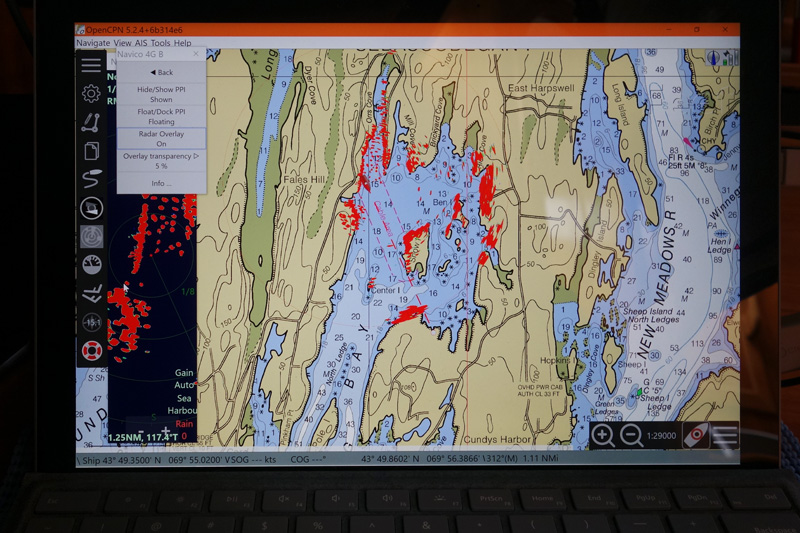
The
Simrad 4G radar image goes to a low-res B&G MFD through Navico's
radar interface RI-10 and Simnet (yellow) proprietary ethernet cables.
(Direct cat-5/RJ45 ethernet connections to a PC are also possible
w/adapter cable(s) or an ethernet switch.) Affinity's
set-up sends the radar to a Simrad 'GoFree' wi-fi router. The PC and OpenCPN also receive NMEA 2000 system
data (GPS, compass, autopilot) on a Cat-5 cable from a 'Nemo Gateway'
multiplexer. Input to the NEMO is on a backbone drop from system N2K on
standard Micro C. Legacy NMEA 0183 data (e.g. wind, depth) can also be
translated by the NEMO for ethernet output. Rose Point Systems does not
allow the Nemo Gateway (probably in the firmware) to output radar. The
Surface PC doesn't have a wired ethernet port, so the Cat5e cable from
the Nemo goes through a gigabit USB-3 adapter.
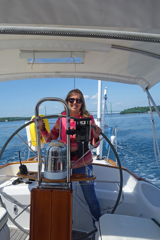
An Asus 16"
monitor x 3/8" thin (!) slides into mounting tracks, designed to cover
the oversized opening left by a removed 12" screen x 7" thick Raymarine
display. That also made cabinet space available for new network
electronics.

Affinity's
nav station - here with NOAA RNC charts and GPS on the large monitor,
dedicated radar on the PC screen. Dual screens on each are also
possible. The 7" B&G low-res multi-function display
with basic included charts is available for assured control of Navico
devices.

Images
and most control functions go, wired or 802.11, to smaller devices at
the helm - Apple, Android or PC - on RAM mounts. For our purposes they
stay dry enough. It's easier to actually see where you're going without
a boom box in the way. And an uncluttered view improves the whole
cockpit. Not to mention choice of pictures!
 |  |
| |
end top
epost.ok@comcast.net